
CINEMATIC + HIGH-RESOLUTION
DJI Mavic 4 Pro
Triple-camera aerial platform centered on a 100 MP 4/3 Hasselblad camera with up to 6K/60 HDR capture. Ideal for premium property, land, construction and commercial visual work.
VIEW PLATFORM ↗Apex combines enterprise drone platforms, thermal imaging, photogrammetry, LiDAR workflows and repeatable reality capture to turn a flight into useful site information—not just another aerial photo.
From a commercial roof showing an abnormal heat pattern to a quarry that needs an updated stockpile volume, Apex builds the capture plan around the question you need answered. We document the site, process the data and organize the result so owners, contractors and project teams can actually use it.
Radiometric thermal imagery can help document temperature differences across commercial and residential roofing systems. We pair thermal views with standard RGB imagery so roofers, property managers and qualified inspectors have visual context for follow-up evaluation.
THERMAL IMAGERY • RGB DOCUMENTATION • ROOF OVERVIEWSRepeatable aerial capture can be processed into 3D surface data for stockpile and material-volume reporting. Useful for aggregate yards, quarries, excavation companies, construction sites and inventory documentation.
VOLUME • INVENTORY • REPEAT CAPTURE • REPORTINGCapture the same site throughout the build to create a visual record of progress. Aerial maps, panoramas, photos and 3D models can help teams compare phases, communicate remotely and preserve a record of site conditions.
PROGRESS • AS-BUILT VISUALS • SITE RECORDSHundreds or thousands of overlapping aerial images can be processed into a high-resolution, map-style view of a property or project. These outputs are useful for planning, documentation and visual communication.
2D MAPS • ANNOTATIONS • DISTANCE • AREAPhotogrammetry turns overlapping imagery into point clouds, textured models and digital surface data. It gives clients a way to view a site from angles that a standard photo set cannot provide.
POINT CLOUDS • 3D MESH • DSM • TERRAINFor projects requiring dense 3D capture, LiDAR workflows can collect point-cloud data across terrain, vegetation and infrastructure. Data can be processed into point clouds and terrain products for qualified project uses.
LIDAR • POINT CLOUD • TERRAIN • INFRASTRUCTUREThermal and high-resolution visual capture can document large sites efficiently and provide a repeatable visual record for qualified inspection and maintenance teams.
SOLAR • UTILITIES • ASSET DOCUMENTATIONLarge-acreage aerial documentation can show access, terrain, improvements, boundaries supplied by the client, water features and overall property context while also supporting marketing deliverables.
ACREAGE • ACCESS • TERRAIN • PROPERTY CONTEXTApex provides aerial capture, mapping, media and data products. Services that legally require a licensed land surveyor, engineer, thermographer or other licensed professional are performed or interpreted by the appropriately qualified party.
Different jobs need different aircraft. Cinematic work needs image quality and movement. Thermal inspection needs radiometric data. Large mapping and LiDAR projects need payload flexibility, endurance and enterprise workflows.
Triple-camera aerial platform centered on a 100 MP 4/3 Hasselblad camera with up to 6K/60 HDR capture. Ideal for premium property, land, construction and commercial visual work.
VIEW PLATFORM ↗
Compact enterprise platform with wide, medium-tele and tele cameras plus a 640×512 thermal imager, laser rangefinder and low-light capability for inspection, documentation and thermal workflows.
VIEW PLATFORM ↗DJI's enterprise flagship supports up to 59 minutes of flight time and payloads up to 6 kg, with integrated LiDAR and mmWave radar obstacle sensing. Built for larger mapping, infrastructure and advanced payload missions.
VIEW ACTUAL AIRCRAFT ↗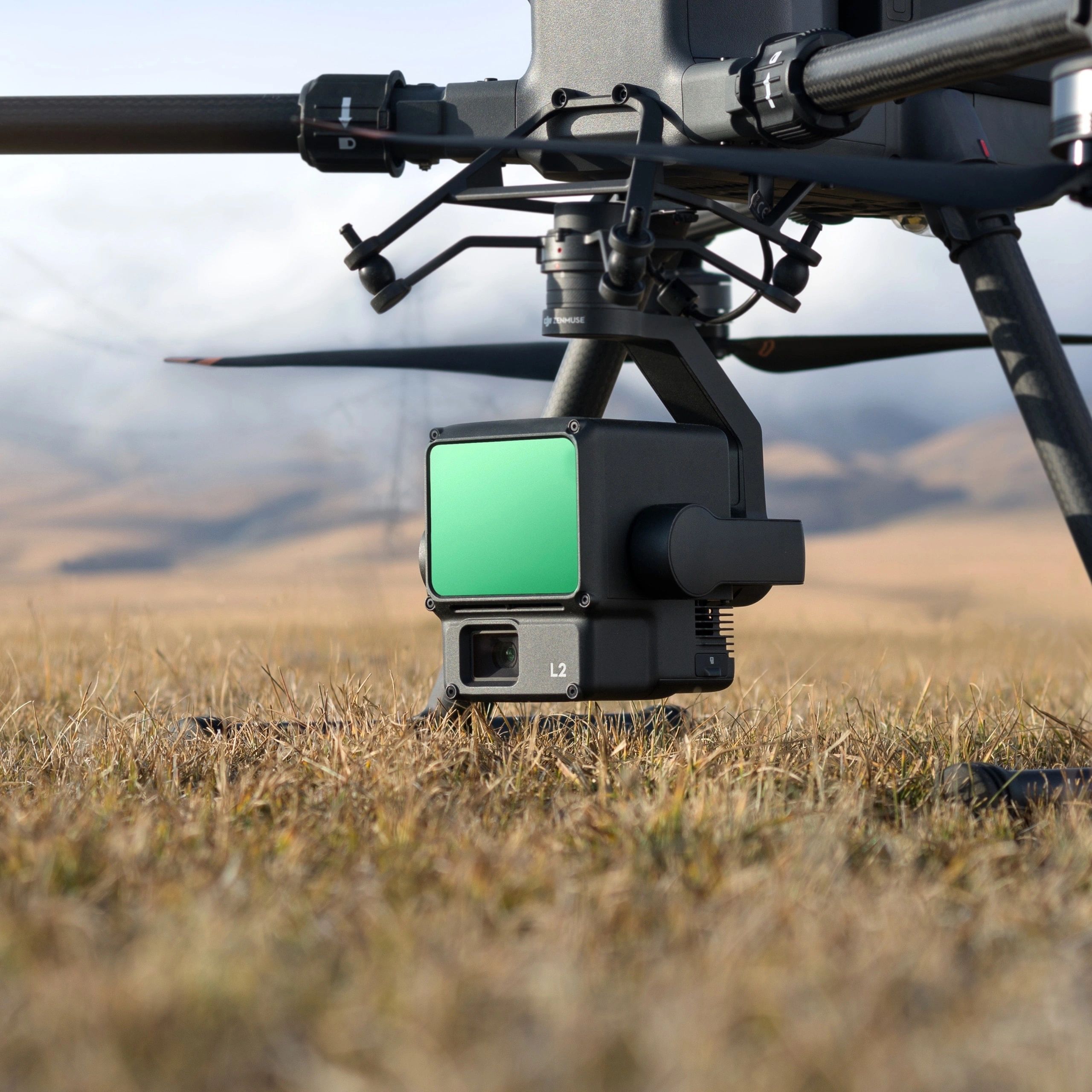
Integrated frame LiDAR, high-accuracy IMU and RGB mapping camera for dense point-cloud acquisition and 3D geospatial workflows when paired with compatible enterprise aircraft and DJI Terra.
VIEW SENSOR ↗
Dedicated cinema platform for high-end aerial filmmaking. The Inspire 2 supports professional Zenmuse cameras and high-resolution recording for commercial films, ranches, developments and brand campaigns.
VIEW PLATFORM ↗Depending on the mission, Apex can move captured imagery through mapping, photogrammetry, LiDAR, thermal-analysis and project-documentation software to create the deliverable the job actually needs.
Reality capture, 2D maps, 3D models, measurements, progress documentation and stockpile reporting. DroneDeploy can centralize maps, photos, panoramas and site data for project teams.
MAPPING • VOLUMES • PROGRESS • 3D 02DJI's mapping and reconstruction software for photogrammetry and LiDAR workflows, including point-cloud processing and 2D/3D reconstruction from compatible DJI capture systems.
LIDAR • POINT CLOUD • RECONSTRUCTION 03Large-scale photogrammetry processing for aerial and terrestrial datasets, with workflows for point clouds, orthomosaics, terrain products, measurements and CAD/GIS-ready outputs.
PHOTOGRAMMETRY • ORTHO • TERRAIN • CAD/GIS 04Thermal-analysis workflow for radiometric imagery captured by compatible DJI thermal cameras, allowing temperature information to be reviewed across areas of interest.
THERMAL • TEMPERATURE DATA • REPORTING 05Cloud-based fleet and mission management for supported enterprise workflows, including live operational awareness, mission planning and centralized project information.
MISSIONS • LIVE VIEW • FLEET • CLOUDWhat needs to be measured, documented, inspected or communicated?
Select the aircraft, sensor, altitude, overlap, repeatability and output requirements.
Capture RGB, thermal, mapping imagery or LiDAR data according to the mission plan.
Build maps, models, point clouds, measurements, reports or organized media.
Provide the project output and, when useful, repeat the capture on a scheduled interval.
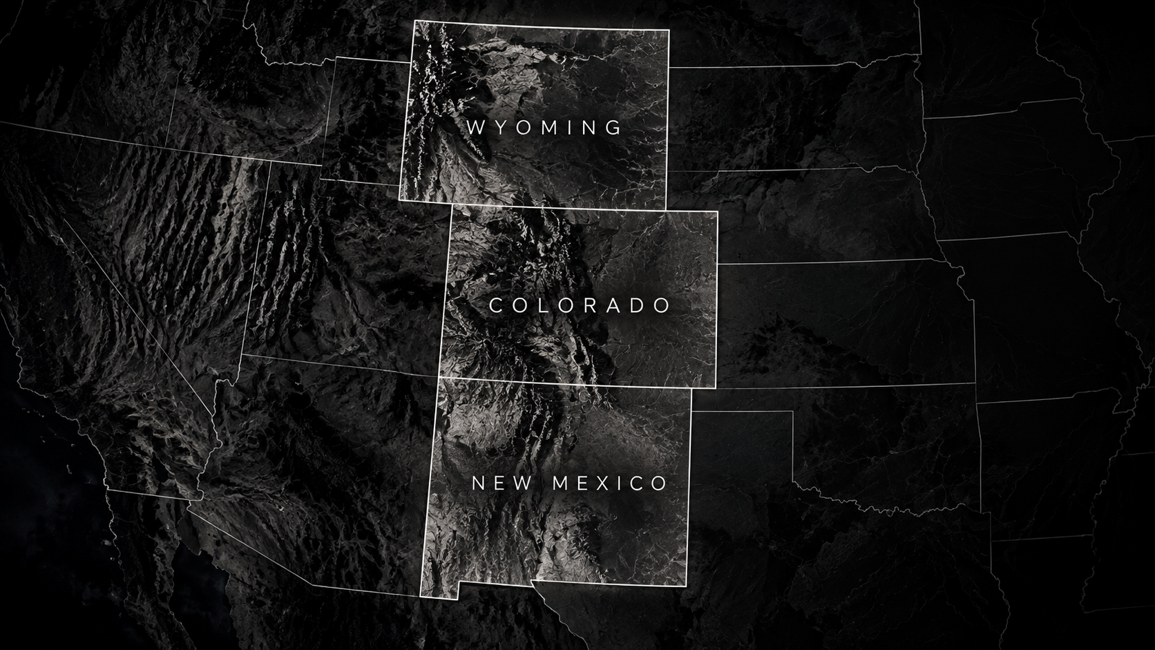
Regional aerial intelligence, thermal, mapping and site-documentation coverage for qualified projects across Colorado, Wyoming and New Mexico.